How to NOT Get Lost While Road Cruising
from
Chris Harper
Website:
www.DeLorme.com
on
December 29, 2001
View comments about this article!
Product Review: Delorme's Earthmate GPS Receiver and 3-D TopoQuad Software
By Chris Harper
Have you ever been lost? I mean, really lost. It's a pretty sickening feeling isn't it. I can still remember getting separated from my parents on a trip to Disney World when I was 2. And I'm not exaggerating. Talk about being embedded in the psyche!
On a hiking trip last year my 13 year old nephew decided to run ahead as we descended Blood mountain on the Appalachian Trail in North Georgia. Near the bottom, he took a fork to the right and my son and I took a fork to the left. We ultimately ended up at the same place, the Walasi Yi Trading Post, but we were about 15 minutes ahead of him. When he finally showed up at the car, the only way I could describe the look on his face is "abject terror". Being the soft hearted individual that I am, I laughed until tears rolled down my face. Mainly because I had predicted this outcome only 30 minutes before to my son. Plain and simple though, being the one that's lost is an unsettling experience. Hence, the reason for this product review.
Field herping and road cruising has led to more than one disoriented individual wandering haplessly on the back roads of some unknown territory far from home. Most secondary roads don't show up at all on regular maps, making topographical maps an absolute necessity in some areas. And topo maps are great if you know how to read them and you also happen to have a compass. I am fortunate enough to have attended one of the US Army's most advanced map reading courses, taught at the JFK Special Warfare Center at Ft. Bragg, NC. This was by far one of the most useful skills that I picked up during my Army stint.
I guess you could say that I am a mapophile, if there is such a thing. So when I saw that the DeLorme map company had combined a GPS unit with 3D topographical map software, I was certainly intrigued. Many of you are already familiar with this company. They produce a book of topo maps of each State called (for example) Georgia Atlas and Gazeteer.
Oh sure, I know what you're saying, "Plenty of companies produce GPS/Computer interface software". But the difference with Delorme's software is that it contains actual scans of USGS topo maps!
For those of you that don't know, GPS stands for Global Positioning System. And a GPS receiver simply picks up navigational signals from US government operated satellites circling the earth in space. Once a GPS unit gets data from at least three of 24 available satellites, it triangulates your location and sends the information back to your recieving unit. With 4 satellites, it can give you altitude data. Then, with the setup that we are reviewing, the GPS unit then sends the information to your laptop computer which displays a detailed map of your location.
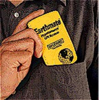
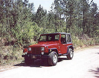
There are several different ways to connect and configure the Earthmate GPS Receiver, so let me describe how I set the system up in my vehicle. My Compaq 1245 laptop is mounted on a Jotto DeskTM mobile computer mount on the passenger side in the front of my '99 Jeep Wrangler.
The computer is plugged into a 160 Watt inverter (available from electonics retailers), which is in turn plugged into the cigarette lighter. Delorme's Earthmate GPS unit is plugged into the back of the laptop, from which it draws it's power. The Earthmate GPS also holds 4 AAA batteries as well and can run on them for several hours if need be. The GPS unit is then placed/ secured on the dashboard. I used one small velcro square.
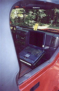
One safety issue to point out here are the driver and passenger side airbags. Currently, the Jotto Desk is mounted in my '99 Jeep Wrangler, which provides the ability to disable the passenger side airbag. If your vehicle doesn't though, you might want to pay attention to where you mount this setup. You wouldn't want the entire thing shoved into your face at 2,000 mph.
Obviously, Delorme's 3D TopoQuad Software is loaded into the CD Rom drive of the laptop. Each State is divided into a number of regions. For instance, Georgia takes up 5 CD's, Florida 6. And remember - the CD's actually contain scanned USGS topographical maps with a zoom feature, I might add. But here's the best part - as you drive, your vehicle is represented by a moving green arrow on the screen and the map on the screen moves with your vehicle -- no matter what pig path you turn down! The accuracy is really phenomenal.
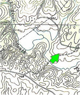
The first time I used the GPS with my laptop, I was astounded to see the arrow on the screen turning with my vehicle in a convenience store parking lot. Then I took it out on some unknown dirt roads in a rural Georgia county and low and behold, there they were on the computer screen. To put it bluntly, if you take the time to learn how to operate this software and equipment, you absolutely cannot get lost.
Yes , I know that this feature is available on many high end vehicles these days, but only as a $2,000 - $4000 add on. If you already have your own laptop, you can expect to spend roughly $100 for each set of State CD Rom's, and about $200 for the GPS unit and cables. Fortunately the software also works with many different GPS units, including the Garmin® 30, 45, GPS II, GPS II Plus, GPS III or GPS 12XL, Magellan™, Rockwell, Trimble Scoutmaster™ or a fully compatible NMEA receiver.
However, you will need to purchase the proper cables to attach your GPS unit to the laptop. [See the website DeLorme.com for more details.]
Let me describe the practical application that I put this system through. In the Spring of 2001 the SHHS went on a field herping trip in the Apalachicola National Forest. To start out, the 3D TopoQuad software was used to navigate the entire distance from Northeast Georgia where I live, to our campground located 12 miles south of Bristol, Florida. At one point our path was blocked by a train that didn't look like it was going to move anytime soon. With myself in the passenger seat acting as the navigator, I was able to talk my driver through a detour in a strange town without ever looking up from the computer screen. Pretty slick.
One interesting feature of the software is that you are able to zoom out to see a multiple State area, or zoom in to see what appears to be roughly a 300 yard stretch of road. Very handy in the right situation. For example, on day 2 of the trip, this feature was used to see exactly where we were in relation to our camp 70 miles away. We had been zoomed in to a small area all day, and didn't really know exactly where we were in relation to Bristol. We had driven up into Seminole County, Georgia to flip some tin since it was a bit too chilly for swamp herping.
My passenger, Mardi Snipes, was not into this new gadget that I was playing with and wanted to stick with what he knew - a county map supplied by the Chamber of Commerce of Seminole County. However, on more than one occasion I did catch him getting his bearings by means of the computer screen.
Since that trip, I have used the system many times to drive on rural county backroads that I have never been down in my life. And in the process, I have discovered some really scenic areas that I probably would have never ventured into.
Looking at a traditional map can be confusing. Are you sure that's the intersection that you're sitting at? Or is it that one? You know what I'm talking about! A GPS/ Computer combination eliminates the guesswork by showing you EXACTLY where you are, and allows you to to relax and enjoy yourself.
Of course you don't need to keep the system operating during your entire trip into back country, but if you were to find yourself passing the same tree over and over, it would certainly be a godsend. Keep in mind that you don't necessarily need the Jotto Desk mobile laptop stand, which runs about $200. The system can operate just as well in the lap of your front seat passenger.
Okay, "So, I can find my way", you're saying. "What else can this system do for a herper?" Well as we all know, captured snakes that are to be released, should be released back at the exact point of capture. This is easily accomplished by "marking a waypoint" with the GPS system and saving it for later use. The software can take you back to the exact spot whenever you decide you want to go there.
One final thing to note is - this is NOT the Topo USA 3.0 Software. That particular version does not contain scans of actual USGS topographical maps. The 3D TopoQuads are much more in depth and useful in field herping situations. However, if you are on a budget the Topo USA 3.0 may suffice, but I haven't worked with it, so I can't really say.
There are many, many features with the 3D TopoQuad software that I haven't gotten into, such as the ability to show a 3D cross section of the terrain you are looking at, computing straight line distances, compass heading and vehicle speed, and a city/town search feature. Too many to list here.
The bottom line is, if you are above average in your computer literacy and map reading skills, you will find this software an absolute joy to use. If you aren't, then try to enjoy your extra time in the back country and be sure to bring along your survival gear! ;-)
The Earthmate GPS Receiver and the 3D TopoQuad Software is available at
www.DeLorme.com.
|
How to NOT Get Lost While Road Cruising
|
Reply
|
|
by ZX11 on February 8, 2003
|
Mail this to a friend!
|
The system utilizied in your Jeep is actually very similar to that used by many trucking companies. It is frequently called a qualcom. The companies use this to track shipments and it helps with logistics engineers to help find more effecient means of transpotrting things. One bonus to them is at any time, the company can contact the driver to inform him/her that a specific service or repair is required for that truck, time for breaks, day off, road trouble ahead, change in plans, even that there is a bridge ahead that is too low for the truck to pass under!! Modern truckers dont use maps much anymore as they are always right there, on the screen in their trucks.No one ever gets lost and deliveries are pinpointed in accuracy. Also, know that such systems help prevent vehicle theft as your vehicle can now be tracked anywhere anytime immediately spelling long prison sentences.15 million trucks on the road--90% have this system...why don't you??
Sorry for the long post. There are just too many reasons to have this system.
|
| |
|
Email Subscription
You are not subscribed to discussions on this article.
Subscribe!
My Subscriptions
Subscriptions Help
Other Recent Articles
 The Spring Egress: Moments with Georgia’s Denning Horridus
 Jameson's Mamba Captive Care
 Captive Care and Breeding of the Monocle
 Keeping Kraits
 I Should Be Dead
|

